Search by Address
Select 'Search by Address or PID' in the dropdown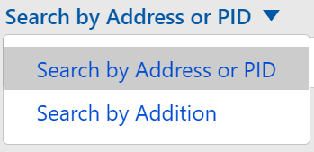
Enter the street address and city with a comma separating the two (e.g. 300 6th Street South, Minneapolis). Zipcodes and state are not needed.
Search by PID
Select 'Search by Address or PID' in the dropdown
Enter a full 13-digit Property Identifier (PID). Hyphens are not required.
Search by Addition
Select 'Search by Addition' in the dropdown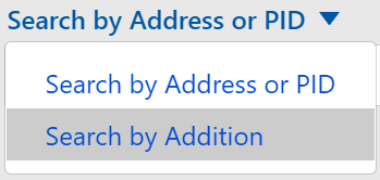
Enter at least 3 characters of the beginning of the addition name (required). A number of suggested addition names will appear. Optionally, add lot and/or block number.
| PID | 0511622130003 |
|---|---|
| Address | 6591 West 168th Ave, Eden Prairie, MN 55346 |
| Owner/Taxpayer | |
| Owner | Enclave At Manor Road Llc |
|---|---|
| Taxpayer | ENCLAVE AT MANOR ROAD LLC 221 S RIVER RIDGE CIR #100 BURNSVILLE MN 55337 |
| Tax Parcel | |
| Parcel Area | 6.43 acres 280,037 sq ft |
| Torrens/Abstract | Torrens |
| Addition | Unplatted 05 116 22 |
| Lot | |
| Block | |
| Metes & Bounds | S 420 Ft Of W 1/2 Of Sw 1/4 Of Ne 1/4 Ex Rd |
| Tax Data (Assessed 2022, Payable 2023) | |
| Market Value | $1,509,300 |
| Total Tax | $19,491.48 |
| Property Type | Residential |
| Homestead | Homestead |
| Year Built | 1985 |
| Tax Data (Assessed 2023, Payable 2024) | |
| Market Value | $1,597,400 |
| Property Type | Residential |
| Homestead | Homestead |
| Year Built | 1985 |
| Sales | |
| Sale Code | Vacant Land |
| Sale Price | $1,150,000 |
| Sale Date | 09/2023 |
| Tax District | |
| School Dist | 272 |
| Sewer Dist | |
| Wateshed Dist | 4 |
- Tax informationLink to current tax page on Hennepin County's website.
- View oblique imageryLink to a viewer that lets you switch between different perspectives such as looking straight down or at an angle to the north, east, south or west.
- View street imagery (Google Maps)Link to Google street view imagery.Google street view imagery is only available for locations near public roadways and will not display imagery for locations outside of Google's street view coverage area. Hennepin County GIS provides a link from our application to Google Maps street view. The Google website is not under the control of Hennepin County and Hennepin County is not responsible for the contents being displayed. Hennepin County is providing this link to you as a convenience only.Read more...
- Survey documentsClick on a link below to view a land survey document19th Century Township Plat filed with the U.S.Surveyor GeneralCurrent property data formatted in 1/2 or 1/8 section mapsProperty data circa 1980 formatted in 1/2 section map. (Excludes Minneapolis)Letter size township map showing the names of section corner monumentsComputation of the distance and direction of lines around the perimeter of sectionsLinks to various PDF maps related to the selected property location. Very large properties, may have multiple sets of documents associated with that property. If needed, turn on the Survey Grid layer from map layers and verify that the property crosses at least one grid line. If it does, simply click on the map in the desired grid sections to see if other documents are available from the Survey Documents link in the results.
- View natural resource informationLink to the Hennepin GIS Natural Resources map.
- About the dataPage containing information about the data (metadata).
Originator
- Hennepin County Resident and Real Estate Services; Survey Division
Title
- Hennepin County Parcel Data
Abstract
This data set is a parcel cadastre. It contains map features similar to those previously shown on hand drawn tax maps. County Auditor's parcel descriptions were collected, interpreted and analyzed. Using coordinate geometry software the descriptions were correlated with survey controlled coordinate values of the Public Land Survey System (PLSS).
The data structure includes point, line, polygon and text features, with each graphic symbol representing a data layer. Several layers may overlap; e.g., a lot line, plat line and right of way limit may coincide and appear as a single line on a hard copy plot. Similar features grouped as major theme categories are designed to collectively represent that theme as an independent unit. For example, municipal, county and state road features combined as a theme are functionally complete as an independent road or transportation layer.
Purpose
- The parcel map base is vital in supporting property and land record operations of Hennepin County.
Time Period of Content Date
- Updated monthly
Currentness Reference
- New plats, lot divisions and other updates of parcel boundary detail are entered based on their recording or official entry in the County record system. Map maintenance is performed on a monthly basis.
Progress
- Parcel updates ongoing
Maintenance and Update Frequency
- Monthly
Spatial Extent of Data
- Parcels features are shown for the entire area of Hennepin County.
Bounding Coordinates
- -93.770378
-93.174303
45.246115
44.784266
Place Keywords
- Independence, Greenfield, Rockford, Mound, Hanover, Shorewood, Maple Plain, Corcoran, Spring Park, Tonka Bay, Minnetonka Beach, Excelsior, Greenwood, Deephaven, Wayzata, Woodland, Minnetonka, Maple Grove, Dayton, Eden Prairie, Hopkins, Champlin, St. Louis Park, Osseo, Brooklyn Park, Edina, Golden Valley, Bloomington, Brooklyn Center, Robbinsdale, Minneapolis, Richfield, MSP Intl Airport, St. Anthony, Medina, Loretto, Orono, Long Lake, Minnetrista, St. Bonifacius, Plymouth, Medicine Lake, New Hope, Crystal, Chanhassen, Ft. Snelling Terr., Rogers, Hennepin County, Minnesota
Access Constraints
- The dataset is available to anyone. Fees are charged according to Hennepin County pricing policy. Online fee schedule.
- Data also available on the Hennepin GIS Open Data website.
Use Constraints
- THE DIGITAL MAP IS FURNISHED ON AN AS IS BASIS, WITHOUT ANY SUPPORT WHATSOEVER, AND WITHOUT REPRESENTATION OR WARRANTY, INCLUDING BUT NOT IN ANY MANNER LIMITED TO FITNESS, MERCHANTABILITY AND COMPLETENESS. The information is neither a legally recorded map nor a survey and is not intended to be used as one. The information is a compilation of records, information and data from various city, county and state offices and other sources and should be used for reference only. No representation is made that the features presented accurately reflect true locations. Hennepin County or any other entity from which data was obtained assumes no liability for any errors or omissions herein. If discrepancies are found, contact the Hennepin County Survey Division.
Contact Information
- Hennepin County Survey Division
- A-703 Government Center
- 300 6th Street South
- Minneapolis, MN 55487-0073
- Phone: 612-348-3131
- Email: surveyor.info@hennepin.us
Attribute Accuracy
Logical Consistency
Completeness
- Complete
Horizontal Positional Accuracy
Parcel features tested to within 2.27' at the 95% confidence level using National Standard Spatial Data Accuracy (NSSDA). 75% of all evaluated points were within 1 foot of computed parcel vertices.
All parcel features are generated by coordinate geometry and based on a framework of accurately located PLSS corner positions used with public information of record. Computed positions of parcel boundaries are not based on individual field surveys. Although tests of randomly selected points may show high accuracy between field and parcel map content, variations between boundary monumentation and legal description of record can and do exist. Caution is necessary in use of land boundary data shown. Contact the Hennepin County Survey Division for more information.
Vertical Positional Accuracy
- n/a
Lineage
- Parcel boundary locations are derived from subdivision plats, registered land surveys, condominium plats, certificates of survey, right of way plats and Hennepin County recorded deed legal descriptions for metes and bounds ownership. These documents range in date from the late 1840's to the present.
Data Organization (not used in this metadata)Horizontal coordinate scheme
- Source data: Hennepin County Ground Feet, NAD83, 1986 non HARN
- Web map: NAD83, UTM Zone 15N
Horizontal datum
- NAD83
Horizontal units
- US Survey Foot
Overview
- The dataset contains a variety of features including parcel lines, parcel PIDs, parcel dimensions, subdivision plat boundaries, road centerlines, road right of way lines, railroads, lakes, rivers and streams. Hennepin County Tax System records (acquired separately) can be attached via the parcel PID.
Detailed citation
Table detail
Publisher
- Hennepin County Resident and Real Estate Services; Survey Division
Contact information
- Hennepin County Survey Division
- A-703 Government Center
- 300 6th Street South
- Minneapolis, MN 55487-0073
- Phone: 612-348-3131
- Email: surveyor.info@hennepin.us
Distributor's data set identifier
- Digital parcel map
Distribution liability
- This data (i) is furnished 'AS IS' with no representation as to completeness or accuracy; (ii) is furnished with no warranty of any kind; and (iii) is not suitable for legal, engineering or surveying purposes. Hennepin County shall not be liable for any damage, injury or loss resulting from this data
Online linkage
- n/a
Metadata date
- 1/28/2022
Contact information
- Hennepin County Survey Division
- A-703 Government Center
- 300 6th Street South
- Minneapolis, MN 55487-0073
- Phone: 612-348-3131
- Email: surveyor.info@hennepin.us
Metadata standard name
- Minnesota Geographic Metadata Guidelines
Metadata Standard Version
- 1.2
Metadata Standard Online Linkage
- Research and obtain land title recordsGoes to Hennepin County Recorders Office page for information on land records.
- Property and survey informationGoes to the Hennepin County Property information web page.
- Hennepin GIS Open DataGoes to the Hennepin GIS open data web page.
- eCRV searchMN Department of Revenue Electronic Certificate of Real Estate Value (eCRV) search.
Search by Address
- Type the address in the search box. Make sure the address contains:
- House number
- Street name
- Directional, if applicable (N, NW, NE, S, SE, SW, E, W)
- Comma for separating the street from the city
- City name
- The search box has address suggestion. As you start typing in an address, a number of suggested addresses will be displayed in a dropdown below the search box. Select one of the addresses in the dropdown by clicking on it or by using the up and down arrow keys.
- Click the search icon next to the search box or click enter to start the search.
Search by PID
- Enter a full 13-digit Property Identifier (PID). Hyphens are not required.
- Click the search icon next to the search box or click enter to start the search.
Search by Addition
- Enter at least 3 characters of the beginning of the addition name (required). A number of suggested addition names will appear.
- Optionally, add lot and/or block number.
- Click 'Search'.
Map Click
- If Survey Monuments are visible and clicked on, a popup is shown with information about that survey monument.
- If Surveyed Properties are visible and clicked, a popup with information about that surveyed property.
- If neither of those layers are visible, or those features are not found where clicked, the property information is returned and the property is highlighted.
- If there are no properties at the location clicked, no results are returned.
Find a PLS section or 1/16 section
- Enter the 7-digit section number, or the 9-digit 1/16 section number in the search box and click the search icon next to the search box or click enter to start the search. This number is the same as the first 7 or 9 digits in a qualified 13-digit Parcel Identifier (PID). A valid entry number starts with a 2-digit section number (add a leading 0 if less than 10), the 3-digit township number (add a leading 0 if needed), and then the 2-digit range number (no leading 0). To get all the way to the 1/16 (or quarter-quarter of the section), add the 2-digit code.
- Examples:
- Generic format: [Sec]-[Town]-[Range]-[1/16 (optional)]
- Section number: 26-029-24 (hyphens are optional)
- 1/16 number: 26-029-24-22 (hyphens are optional)
To turn on a map layer, click the 'Map Layers' button and click on the check box for the map layer you want to view. If the checkbox is grayed out and cannot be clicked, zoom into the map to enable the checkbox.
- Parcel Annotation
Notations and lines used by surveyors to detail specific information regarding ownership and detailed survey information. - House Number
The assigned house number (address) for that property. - Survey Monuments
GPS defined locations with associated tie-sheets. - Survey Grid
The PLSS grid system of Township, Range, Section, and 1/16 sections. - Surveyed Properties
Boundaries of locations where official surveys have taken place. - Abstract/Torrens/Both
If the property is abstract, torrens or both. - Market Value Asmt Yr 2022
The total market value of the property based on the 2022 assessment (for taxes payable 2023). This data is generally available beginning in April of the assessment year specified. - Market Value Asmt Yr 2023
The total market value of the property based on the 2023 assessment (for taxes payable 2024). This data is generally available beginning in April of the assessment year specified. - Recently Sold
Most current sale in the past 36 months. Comparable sales are shown in black text (or yellow if displayed over aerial imagery), and excluded sales are shown in red. Excluded sales are not used in the assessment process. Examples of excluded sales include but are not limited to bank sales, sales between related parties, properties that are in division, or properties with a physical change.
A map can be created as a PDF or an image such as a JPG or PNG. Once created, the map can then be printed or saved.
To create a printable map:
- Click the 'Tools' button on the right side of the application. Then select the 'Print' button. Or after making a selection in the map, click the print icon in the top right corner of the results.
- Once the print dialog opens, select the file format you would like to create.
- If you would like comments added to the map, add them in the 'Comments' section. This is optional. There is a 240 character limit for the comments.
- Click on the 'Create ...' button.
- If map creation is successful, a link will be created. Click on the link to open the map.
- From here, you can then save or print the map.
- After printing, if no map opens in a new page and there is no error message, make sure that pop-ups are not blocked for this page.
This data (i) is furnished 'AS IS' with no representation as to completeness or accuracy; (ii) is furnished with no warranty of any kind; and (iii) is not suitable for legal, engineering or surveying purposes. Hennepin County shall not be liable for any damage, injury or loss resulting from this data.
Property tax information:
- Hennepin County Property Tax Division
- taxinfo@hennepin.us
- Phone: 612-348-3011
- Web: Property tax information
Survey information:
- County Surveyor's Office
- surveyor.maps@hennepin.us
- Phone: 612-348-3131
- Web: Surveyor's Office maps and data
Recorder information:
- Recorder - Registrar of Titles
- recordinginfo@hennepin.us
- Phone: 612-348-5139
- Web: Real estate recording information
Assessment information:
- Assessor
- assessor.ao@hennepin.us
- Phone: 612-348-3046
- Web: Assessor
Lead mitigation:
- Lead Hazard Control and Healthy Homes
- healthyhomes@hennepin.us
- Phone: 612-543-4182
General application assistance:
- Hennepin GIS
- If you are experiencing any issues or have questions about the application, submit a request on the Hennepin GIS Request Assistance page.
- Web: Hennepin GIS
- Email: gis.info@hennepin.us
Send us your feedback
Please contact Hennepin GIS if you are experiencing any issues or have questions about the application.
To contact Hennepin GIS:
- submit a request on the Hennepin GIS Request Assistance page
or
- email Hennepin GIS at gis.info@hennepin.us
Other resources
Visit the Hennepin GIS homepage to explore more Hennepin GIS applications, open data and other resources.
